
 |
Kangding Airport was opened in October 2008. It is 40 km distance from Kangding / Dartsendo town, next to Gye La / Zheduo Shankou at an altitude of 4,280 m, around 1600m above Kangding. The drive could take you two hours. Back then it was globally second only to Bangda Airport (4334m) near Chamdo / Qamdo in TAR. (Elevations from a Xinhua article from 10-22-2008).
I could not believe how long the runway is that has been constructed, 4 kilometers! Pictured here is only a fraction of the tarmac. The air is very thin in this extreme altitude, but may be the authorities wanted to be prepared to land big planes with lots of heavy gear. It accommodates Boeing 737-700s and Airbus 318.
The 35 minutes tourist flight from Chengdu cost CNY 1000 (US$ 140) in 2008. It does not operate year round. In 2009 it opened in late April again.
© Daniel Winkler, Dartsendo / Kangding County, Ganzi TAP, July 2009, 4200-4300m
|
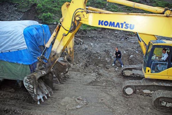 |
Gye La / Zheduo Shankou pass above Kangding / Dartsendo town, the door to the Tibetan Plateau in West Sichuan, has had awful road conditions for years. The road is being under construction to improve airport access. Getting stuck there for hours is a frequent experience.
Here it took two Japanese excavators to push a truck out of the mud. It seemed like the equipment operators did not care about the hundreds of vehicles being trapped for hours, but rather enjoyed using their machines for more entertaining activities, than digging up the old road.
© Daniel Winkler
Kangding County, Ganzi TAP, July 2009, 4200-4300m
|
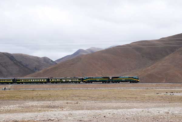 |
The train pulled by two Diesel locomotives between Yangpachen and Damshung. © Daniel Winkler, Damshung County / Dangxiong Xian, Tibet AR, May 2009
|
Mining in Eastern Tibet
 |
-
Artesian mining, especially for gold is common in the Tibetan areas. Here near Dage (Dagai / Dagain) gold washing can be observed during the winter months, when the water is clear and much lower than during the summer monsoon.
© Daniel Winkler
Nyarong / Xinlong County, Ganzi TAP, Nov. 2001, 3200m.
|
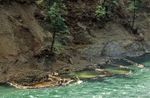 |
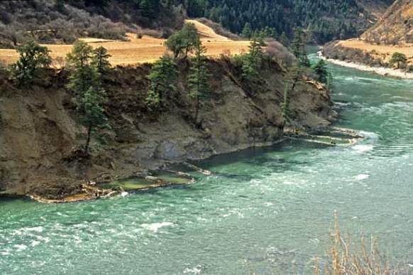
Cofferdams were built to keep the waters of the Nya Chu (Yalong Jiang) out to dig up the sediments to pan for gold. To me it looked like locals were mining here. After building the cofferdams, they were using gas powered pumps to empty the enclosure from water or leakage, to pan for gold sediments.
© Daniel Winkler
Nyarong / Xinlong County, Ganzi TAP, Nov. 2001, 3200m.
|
 |
Gold mining by low-land Sichuanese migrants mining for gold in alluvial sediments.
© Daniel Winkler
Tawu / Daofu County, Ganzi TAP, Aug. 1998, 3400m.
|
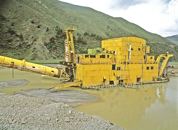 |
Industrial alluvial sediment gold mining in Lithang. A huge floating contraption that was driven up onto the plateau in many parts by hundreds of trucks. Gold panning of alluvial sediments taken to a different level.
© Daniel Winkler Lithang County / Litang Xian, Kandze / Ganzi TAP, June 1999, 4200m.
|
If you would like to use any of my photos please contact me by email
last changed March 17, 2013